
Arctic Ocean – one of the six volumes of “The Atlas of the Oceans,” a fundamental academic and cartographic work published in 1980. The volume contains maps and brief comments arranged by sections: ocean research history, bottom and shores, climate, hydrology (hydrophysics), hydrochemistry, biogeography, reference, and navigation geography materials. The sections contain maps of the most important voyages and expeditions, relief, morphometric characteristics, earthquakes and volcanoes, geomorphology, bottom sediments, water heat balance, air temperature, atmospheric circulation visibility, atmospheric fronts and climatic zones, water temperature, salinity and density, speed of sound, surface and bottom currents, level fluctuations, swelling, tides, chemical elements, life distribution patterns, etc. A total of 184 maps are available.


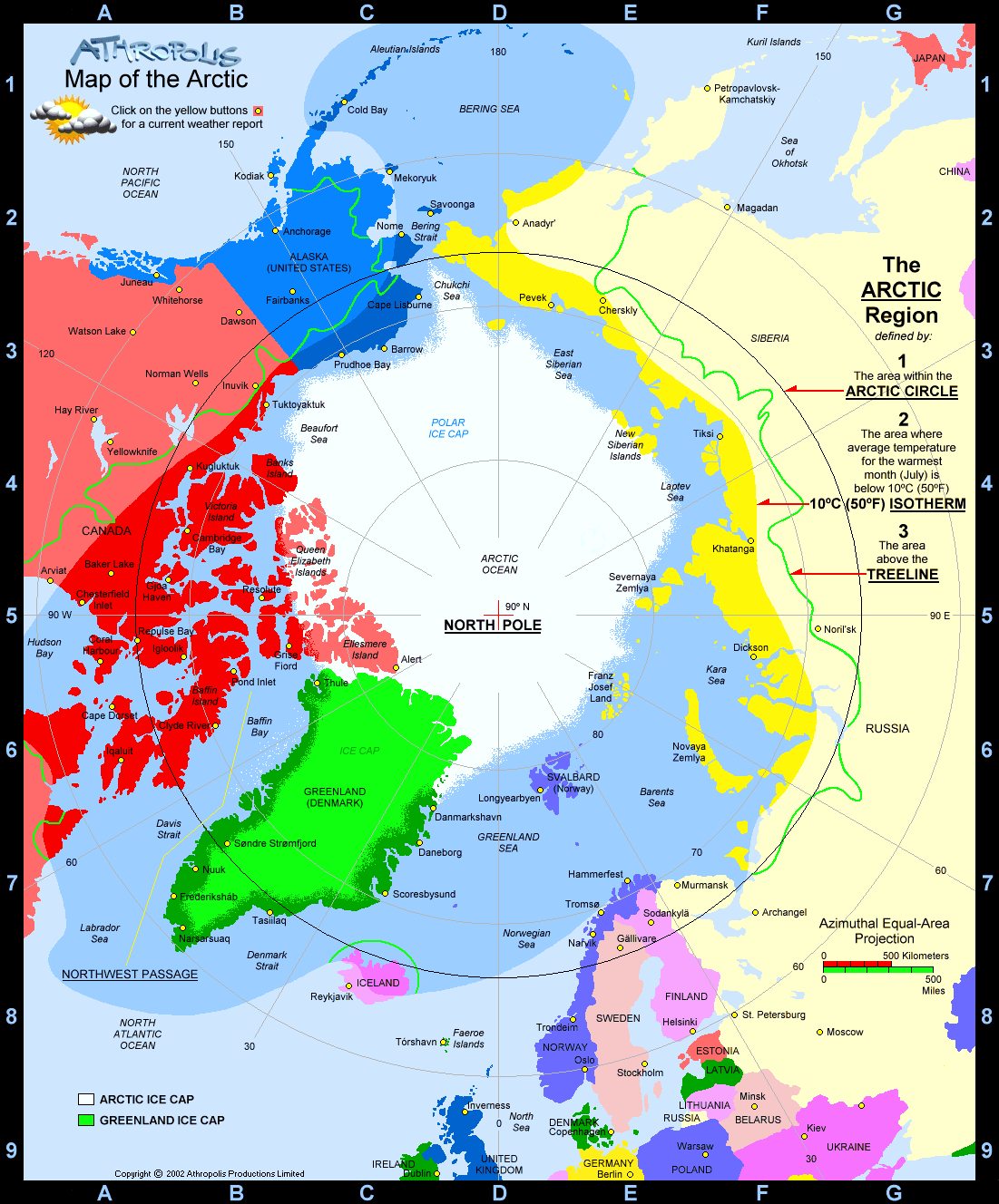
Arctic Ocean (http://www.athropolis.com/graphics/arcticmap4-new.gif)
Access this chapter
Tax calculation will be finalised at checkout
Purchases are for personal use only
Rights and permissions
Copyright information
© 2017 Springer International Publishing Switzerland
About this entry
Cite this entry
(2017). Arctic Ocean . In: The Western Arctic Seas Encyclopedia. Encyclopedia of Seas. Springer, Cham. https://doi.org/10.1007/978-3-319-25582-8_10045
Download citation
DOI: https://doi.org/10.1007/978-3-319-25582-8_10045
Published:
Publisher Name: Springer, Cham
Print ISBN: 978-3-319-25581-1
Online ISBN: 978-3-319-25582-8
eBook Packages: Earth and Environmental ScienceReference Module Physical and Materials ScienceReference Module Earth and Environmental Sciences