
Abstract
Profound impacts of climate change occur at regional levels, affecting, among others, ecosystems, agriculture, hydrology, and carbon cycle at global levels. These changes will have signficant impacts on all aspects of human societies, including food, water, energy, and, not least, the economy itself. In particular, major uncertainties exist for natural and managed ecosystems. We will start by demonstrating the physical fundamentals of the global phenomenon of climate change, its origin and greenhouse gasses emissions, lifetimes, its global impact on critical sectors and resources of sustainable development. Then, we emphasize the vulnerability of Egypt to climate changes and the need for large-scale, global systems for monitoring, modeling, assessment, and follow-up of mitigation and adaptation measures. An outline of the capabilities of remote sensing and GIS techniques for monitoring, mitigating, assessing vulnerabilities to impacts, success stories, modeling, and early warning of extreme events in Egypt, is presented. We end up with an assessment of the needs of Egypt to fulfill its strategic development goals (SDGs) in harmony with reducing the risk of climate change.
Access this chapter
Tax calculation will be finalised at checkout
Purchases are for personal use only
Abbreviations
- AATSR:
-
Advanced Along Track Scanning Radiometer
- AMSRE:
-
Advanced Microwave Scanning Radiometer-EOS
- AVHRR:
-
Advanced Very High Resolution Radiometer
- CDM:
-
Cleaner Development Mechanism
- COP:
-
Conference of Parties
- EEAA:
-
Egyptian Environmental Affairs Agency
- ESA:
-
European Space Agency
- GHRSST:
-
Group for High Resolution Sea Surface Temperature
- GMES:
-
Global Monitoring for Environment and Sustainability
- GOES:
-
Geostationary Operational Environmental Satellite Imager
- GOSAT:
-
Greenhouse Gas Satellite
- ICZM:
-
Integrated Coastal Zone Management Plan
- IPCC:
-
Intergovernmental Panel of Climatic Changes
- JAXA:
-
Japan Aerospace Exploration Agency
- LST:
-
Land Surface Temperature
- MODIS:
-
Moderate Resolution Imaging Spectroradiometer
- MOEJ:
-
The Ministry of the Environment, Japan
- MTSAT-1R:
-
Multi-functional Transport Satellite 1R
- NASA:
-
National Aeronautics and Space Administration
- NIES:
-
National Institute for Environmental Studies, Japan
- NOAA:
-
National Oceanic and Atmospheric Administration
- SDG:
-
Sustainable (Strategic) Development Goals
- SEVIRI:
-
Spinning Enhanced Visible and Infrared Imager
- SLR:
-
Sea Level Rise
- SRTM:
-
Shuttle Radar Topography Mission
- SST:
-
Sea Surface Temperature
- TMI:
-
Tropical Rainfall Measuring Mission Microwave Imager
- TNC:
-
Third National Communication
- TRMM:
-
Tropical Rainfall Monitoring Mission
- TSP:
-
Total Suspended Particulates
- UNFCCC:
-
UN Framework Convention on Climate Changes
- WMO:
-
World Meteorological Organization
References
Aboel Fetouh Y, El-Askary H, El-Raey M, Allali M, Sprigg WA, Kafatos M (2013) Annual patterns of atmospheric pollutions and episodes over Cairo Egypt. Adv Meteorol 2013:1–11
AerosolWatch (2018) GOES-16 image of Hurricane Frances on September 10, 2018 at 1600 UTC. Retrieved from https://www.star.nesdis.noaa.gov/smcd/spb/aq/AerosolWatch
Agrawala S, Moehner A, El-Raey M, Conway D, Van Aalst M, Hagenstad M et al (2004) Development and climate change in Egypt: focus on coastal resources and the Nile. Organisation for Economic Co-operation and Development
Ahmed S (2017) Environmental risk assessment in the city of Alexandria using remote sensing and GIS. Ph.D. thesis
Almazroui M (2011) Sensitivity of a regional climate model on the simulation of high intensity rainfall events over the Arabian Peninsula and around Jeddah (Saudi Arabia). Theor Appl Climatol 104(1–2):261–276
Becker RH, Sultan M (2009) Land subsidence in the Nile Delta: inferences from radar interferometry. Holocene 19(6):949–954
Central Agency for Public Mobilization and Statistics (CAPMAS) (2016) Statistical year book
Cools J, Vanderkimpen P, Afandi GE, Abdelkhalek A, Fockedey S, Sammany ME et al (2012) An early warning system for flash floods in hyper-arid Egypt. Nat Hazards Earth Syst Sci 12(2):443–457
Deutscher Wetterdienst (2018) Weather satellites around the world. Retrieved from https://www.dwd.de/EN/research/observing_atmosphere/satellites/weather_satellites_node.html
Dubovik O, King MD (2000) A flexible inversion algorithm for retrieval of aerosol optical properties from sun and sky radiance measurements. J Geophys Res Atmos 105(D16):20673–20696
Dubovik O, Smirnov A, Holben BN, King MD, Kaufman YJ, Eck TF et al (2000) Accuracy assessments of aerosol optical properties retrieved from Aerosol Robotic Network (AERONET) sun and sky radiance measurements. J Geophys Res Atmos 105(D8):9791–9806
Dubovik O, Holben B, Eck TF, Smirnov A, Kaufman YJ, King MD et al (2002) Variability of absorption and optical properties of key aerosol types observed in worldwide locations. J Atmos Sci 59(3):590–608
Egyptian Environmental Affairs Agency (EEAA) (2010) Egypt second national communication under the United Nations Framework Convention on Climate Change (UNFCCC). Egypt Environmental Affairs Agency, Cairo
El-Askary H (2006) Air pollution impact on aerosol variability over mega cities using remote sensing technology: case study, Cairo Egypt. Egypt J Remote Sens Space Sci 9:31–40
El-Askary H, Kafatos M (2008) Dust storm and black cloud influence on aerosol optical properties over Cairo and the Greater Delta region Egypt. Int J Remote Sens 29(24):7199–7211
El-Askary H, Abd El-Mawla SH, Li J, El-Hattab MM, El-Raey M (2014) Change detection of coral reef habitat using Landsat-5 TM, Landsat 7 ETM+ and Landsat 8 OLI data in the Red Sea (Hurghada, Egypt). Int J Remote Sens 35(6):2327–2346
El-Askary H, Li J, Li W, Piechota T, Ta T, Jong A et al (2018) Impacts of aerosols on the retreat of the Sierra Nevada Glaciers in California. Aerosol Air Qual Res 18(5):1317–1330
El-Askary H, Li W, El-Nadry M, Awad M, Mostafa AR (2019) Strong interactions indicated between dust aerosols and precipitation related clouds in the Nile Delta. In: El-Askary HM et al (eds) Advances in remote sensing and geo informatics applications. Springer International Publishing, Cham, pp 1–4
Elbeih SF (2015) An overview of integrated remote sensing and GIS for groundwater mapping in Egypt. Ain Shams Eng J 6(1):1–15
El-Hattab MM, Mohamed SA, El-Raey M (2018) Potential tsunami risk assessment to the city of Alexandria, Egypt. Environ Monit Assess 190(9)
El-Magd IA, Hasan A, El Sayed A (2015) A century of monitoring urban growth in Menofya Governorate, Egypt, using remote sensing and geographic information analysis. JGIS 07:402–414
El-Raey M (1997) Vulnerability assessment of the coastal zone of the Nile Delta of Egypt, to the impacts of sea level rise. Ocean Coast Manage 37(1):29–40
El-Raey M (2011) Mapping areas affected by sea-level rise due to climate change in the Nile Delta until 2100. In: Coping with global environmental change, disasters and security. Springer, Berlin, Heidelberg, pp 773–788
El-Raey M, Fouda Y, Nasr S (1997) GIS assessment of the vulnerability of the Rosetta area, Egypt to impacts of sea rise. Environ Monit Assess 47(1):59–77
El-Raey M, Frihy O, Nasr SM, Dewidar KH (1999a) Vulnerability assessment of sea level rise over Port Said Governorate, Egypt. Environ Monit Assess 56(2):113–128
El-Raey M, Dewidar KR, El-Hattab M (1999b) Adaptation to the impacts of sea level rise in Egypt. Mitig Adapt Strat Glob Change 4(3–4):343–361
El-Raey M, Nasr S, Frihy O, Desouki S, Dewidar K (1995) Potential impacts of accelerated sea-level rise on Alexandria Governorate, Egypt. J Coast Res 190–204
Food and Agriculture Organization (2011) FAO vulnerability map for Egypt. Retrieved from https://www1.wfp.org
Hemming D, Iowe J, Biginton M, Betts R, Ryall D (2007) Impacts of mean sea level rise based on current state-of-the-art modeling. Hadley Centre for Climate Prediction and Research, Exeter, UK
Intergovernmental Panel on Climate Changes (2014a) Fourth assessment report (IPCC-AR4)
Intergovernmental Panel on Climate Changes (2014b) Fifth assessment report (IPCC-AR5)
Japan Aerospace Exploration Agency (JAXA) (2015, Oct 31) JAXA global rainfall watch. Retrieved from https://sharaku.eorc.jaxa.jp/GSMaP
Kim S-R, Prasad AK, El-Askary H, Lee W-K, Kwak D-A, Lee S-H et al (2014) Application of the Savitzky-Golay filter to land cover classification using temporal MODIS vegetation indices. Photogrammetric Eng Remote Sens 80(7):675–685
Lauvaux T, Miles NL, Deng A, Richardson SJ, Cambaliza MO, Davis KJ et al (2016) High-resolution atmospheric inversion of urban CO2 emissions during the dormant season of the Indianapolis Flux Experiment (INFLUX). J Geophys Res Atmos 121(10):5213–5236
Li W, El-Askary H, ManiKandan K, Qurban M, Garay M, Kalashnikova O (2017) Synergistic use of remote sensing and modeling to assess an anomalously high chlorophyll-a event during summer 2015 in the South Central Red Sea. Remote Sens 9(8):778
Li W, El-Askary H, Qurban M, Proestakis E, Garay M, Kalashnikova O et al (2018) An assessment of atmospheric and meteorological factors regulating Red Sea phytoplankton growth. Remote Sens 10(5):673
Li W, El-Askary H, Qurban M, Allali M, Manikandan KP (2019) On the drying trends over the MENA countries using harmonic analysis of the enhanced vegetation index. In: El-Askary HM et al (eds) Advances in remote sensing and geo informatics applications. Springer International Publishing, Cham, pp 181–183
Marey HS, Gille JC, El‐Askary HM, Shalaby EA, El‐Raey ME (2010) Study of the formation of the “black cloud” and its dynamics over Cairo, Egypt, using MODIS and MISR sensors. J Geophys Res Atmos 115(D21)
Marey HS, Gille JC, El-Askary HM, Shalaby EA, El-Raey ME (2011) Aerosol climatology over Nile Delta based on MODIS, MISR and OMI satellite data. Atmos Chem Phys 11(20):10637–10648
Masria A, Negm A, Iskander M, Saavedra O (2014) Coastal zone issues: a case study (Egypt). Procedia Eng 70:1102–1111
McCarl BA, Musumba M, Smith JB, Kirshen P, Jones R, El-Ganzori A et al (2015) Climate change vulnerability and adaptation strategies in Egypt’s agricultural sector. Mitig Adapt Strat Glob Change 20(7):1097–1109. https://doi.org/10.1007/s11027-013-9520-9
Moss R, Babiker M, Brinkman S, Calvo E, Carter T, Edmonds J et al (2008) Towards new scenarios for analysis of emissions, climate change, impacts, and response strategies. Intergovernmental Panel on Climate Change, Geneva, p 132
Nakajima T, Tonna G, Rao R, Boi P, Kaufman Y, Holben B (1996) Use of sky brightness measurements from ground for remote sensing of particulate polydispersions. Appl Opt 35(15):2672–2686
Nile Basin Initiative (2012) State of the River Nile basin. Nile Basin Initiative Secretariat, Entebbe, Uganda
National Aeronautics and Space Administration (NASA) (2005) Dust storm across the Red Sea. Retrieved from https://visibleearth.nasa.gov/view.php?id=72897
National Aeronautics and Space Administration (NASA) (2011) Global climate change: vital signs of the planet. Retrieved from https://climate.nasa.gov/
National Aeronautics and Space Administration (NASA) (2014) A-train constellation with details. Retrieved from https://oco.jpl.nasa.gov/galleries/galleryspacecraft/
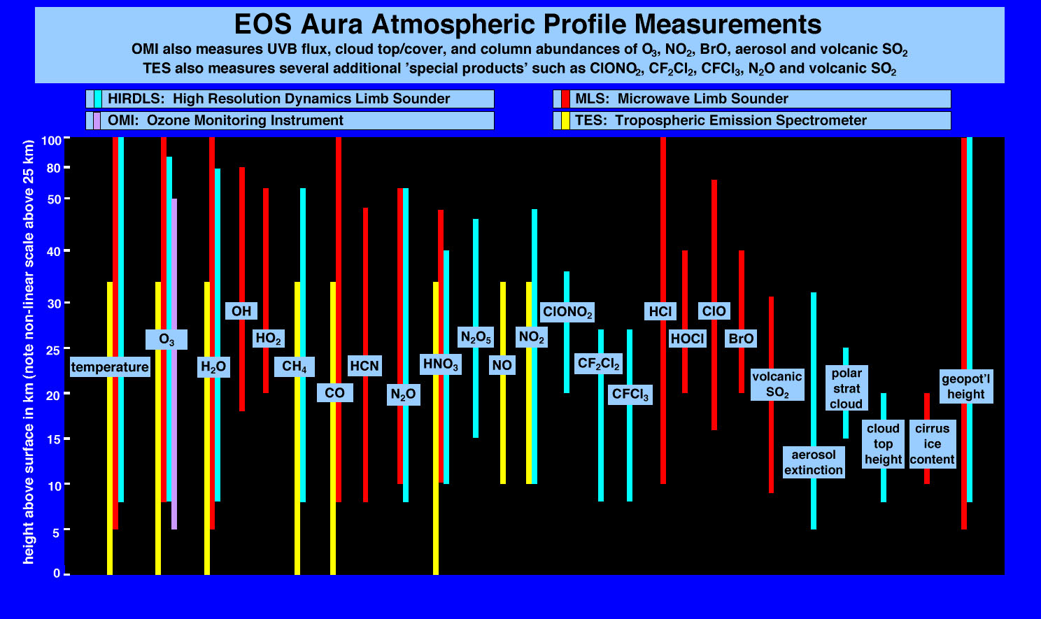
National Aeronautics and Space Administration (NASA) (2018) EOS Aura atmosphere profile measurements. Retrieved from https://aura.gsfc.nasa.gov/images/instruments/eoschemchart_big.jpg
National Oceanic and Atmospheric Administration (NOAA) (1996) Hurricane Fran near peak intensity on September 4, 1996 at 1700Z. Retrieved from class.ncdc.noaa.gov
Natural Resources Canada (2016) Fundamentals of remote sensing tutorial [PDF file]. Retrieved from https://www.nrcan.gc.ca/sites/www.nrcan.gc.ca/files/earthsciences/pdf/resource/tutor/fundam/pdf/fundamentals_e.pdf
Nerem RS, National Center for Atmospheric Research Staff (eds) (2016, Jan 19). The climate data guide: global mean sea level from TOPEX & Jason Altimetry. Retrieved from https://climatedataguide.ucar.edu/climate-data/global-mean-sea-level-topex-jason-altimetry
NOAA National Centers for Environmental Information (2018a) State of the climate: global climate report for June 2018. Retrieved from https://www.ncdc.noaa.gov/sotc/global/201806
NOAA National Centers for Environmental information (2018b) Climate at a glance: global time series. Retrieved from https://www.ncdc.noaa.gov/cag/
Prasad AK, El-Askary H, Kafatos M (2010) Implications of high altitude desert dust transport from Western Sahara to Nile Delta during biomass burning season. Environ Pollut 158(11):3385–3391
Sestini G (1989) Implications of climate change for the Nile Delta. Report WG 2/14. UNEP/OCA, Nairobi
Smith JB, McCarl BA, Kirshen P, Jones R, Deck L, Abdrabo MA et al (2014) Egypt’s economic vulnerability to climate change. Clim Res 62(1):59–70
Solomon S, Qin D, Manning M, Averyt K, Marquis M (eds) (2007) Climate change 2007-the physical science basis: working group I contribution to the fourth assessment report of the IPCC, vol 4. Cambridge University Press, Cambridge
Stanley DJ, Warne AG (1993) Nile Delta: recent geological evolution and human impact. Science 260(5108):628–634
Stern N (2008) The economics of climate change. Am Econ Rev 98(2):1–37
Strzepek KM, Onyeji SC, Saleh M, Yates D (1995) An assessment of integrated climate change impacts on Egypt. Cambridge University Press, Cambridge, UK and New York, NY, USA, pp 180–200
Strzepek KM, Yates DN, El Quosy DED (1996) Vulnerability assessment of water resources in Egypt to climatic change in the Nile basin. Clim Res 6(2):89–95
Sušnik J, Vamvakeridou-Lyroudia LS, Savić DA, Kapelan Z (2013) Integrated modelling of a coupled water-agricultural system using system dynamics. J Water Clim Change 4(3):209–231
Sušnik J, Vamvakeridou-Lyroudia LS, Baumert N, Kloos J, Renaud FG, La Jeunesse I et al (2015) Interdisciplinary assessment of sea-level rise and climate change impacts on the lower Nile Delta, Egypt. Sci Total Environ 503:279–288
The Sustainable Agricultural Development Strategy towards 2030 (SADS) (2010) Agricultural Research & Development Council (ARDC)
Third National Communication (TNC) (2016) Egypt third national communication under the United Nations Framework Convention on Climate Change (UNFCCC). Egypt Ministry of Environment
Tolba MK, Saab NW (2009) Arab environment: climate change. Beirut, Arab forum for environment and development
Whitney K, Scudiero E, El-Askary HM, Skaggs TH, Allali M, Corwin DL (2018) Validating the use of MODIS time series for salinity assessment over agricultural soils in California, USA. Ecol Ind 93:889–898
Wurl D, Grainger RG, McDonald AJ, Deshler T (2010) Optimal estimation retrieval of aerosol microphysical properties from SAGE~II satellite observations in the volcanically unperturbed lower stratosphere. Atmos Chem Phys 10(9):4295–4317
Yang J, Gong P, Fu R, Zhang M, Chen J, Liang S et al (2013) The role of satellite remote sensing in climate change studies. Nat Clim Change 3(10):875
Author information
Authors and Affiliations
Corresponding author
Editor information
Editors and Affiliations
Rights and permissions
Copyright information
© 2020 Springer Nature Switzerland AG
About this chapter

Cite this chapter
Raey, M.E., Askary, H.E. (2020). Remote Sensing and Modeling of Climate Changes in Egypt. In: Elbeih, S., Negm, A., Kostianoy, A. (eds) Environmental Remote Sensing in Egypt. Springer Geophysics. Springer, Cham. https://doi.org/10.1007/978-3-030-39593-3_14
Download citation
DOI: https://doi.org/10.1007/978-3-030-39593-3_14
Published:
Publisher Name: Springer, Cham
Print ISBN: 978-3-030-39592-6
Online ISBN: 978-3-030-39593-3
eBook Packages: Earth and Environmental ScienceEarth and Environmental Science (R0)